Romantik Blog
The Nagelfluhkette. A wild natural wonder in the southern Allgäu.
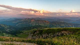
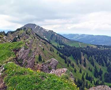
Between Allgäu and Bregenzerwald, ancient rocks meet species-rich mountain meadows, rugged rocks meet deep green forests, babbling rivers meet mystical moors, clear mountain air meets magical views and wild chamois meet peaceful cow pastures. When you enter the Nagelfluhkette, you enter a piece of unspoiled nature that touches, moves and lingers for a long time. Discover the Nagelfluhkette and great accommodation for your Allgäu vacation.
What makes the Nagelfluhkette special.
- Geology you can touch: The name “Nagelfluh” comes from the special rock - a conglomerate of boulders and limestone that looks like river stones glued together. If you take a closer look, you will recognize millions of years of geological history.
- 1st cross-border nature park: The Nagelfluhkette Nature Park stretches across Bavaria and Vorarlberg - a role model for sustainable tourism, alpine pasture management and nature conservation.
- Alpine pasture culture at its best: over 100 managed alpine pastures invite you to stop for a bite to eat. With mountain cheese, buttermilk and snacks. It doesn't get any fresher or more authentic than this.
Places you have to see.
Hochgrat (1,834 m): The highest peak in the chain, with magnificent views of Lake Constance all the way to Switzerland. The sunsets here? Magical.
Steibis & Oberstaufen: The perfect starting point for tours. Charming, lively, with Bavarian warmth. Ideal for wellness after a hike.
Gunzesried & Blaichach: Dreamy mountain villages, clear torrents, pristine nature. An insider tip for those seeking peace and quiet and individualists.
Sibratsgfäll & Hittisau (Vorarlberg): Austria's part of the chain: quieter, more alpine, charmingly authentic. Here, Nagelfluh meets wooden architecture and a cheese route.
Nagelfluh ridge hike. The Königstour.
- Start/finish: Hochgratbahn - Imbergbahn
- Length: approx. 15 km
- Duration: 6-7 hours
- Character: Demanding, panoramic, alpine
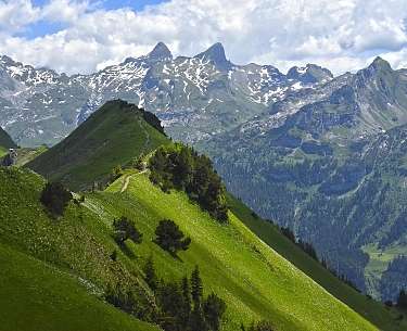
- Highlight: Seven summits in one day. From Hochgrat via Seelekopf, Hohenfluhalpkopf to Stuiben.
This ridge hike is the absolute highlight of the region. You march from summit to summit on a narrow path across an impressive line of rock. The Alps in view, the valley at your feet.
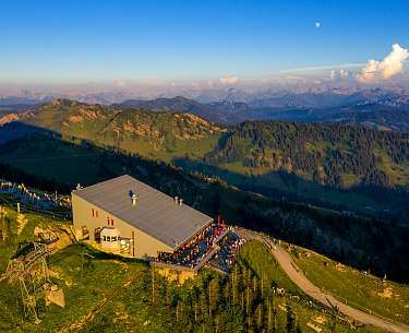
Hochgrat Panorama Trail.
- Start: Hochgratbahn valley station
- Length: 7 km (circular route)
- Character: Pleasure route for hikers with panoramic views
- Highlight: Ascent with the nostalgic Hochgratbahn, refreshment stop at the Staufner Hütte
Ideal for relaxed hiking days with plenty of views and little effort. Also perfect for families.
Photo: Ralf Lienert/Hochgratbahn
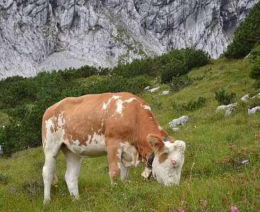
Alpine adventure trail on the Imberg.
- Place: Steibis/Oberstaufen
- Length: approx. 6 km
- Who for: Families with children, leisure hikers
- Special feature: Themed stations on alpine life, geology and flora of the Nagelfluhkette
An adventure trail close to nature with information and play stations. And yes, real cows and goats also cross the path.
The Nagelfluhkette. Where alpine magic meets nature conservation.
Since 2024, the cross-border Nagelfluhkette Nature Park has covered 480 square kilometers and connects 18 municipalities across national borders - a model for sustainable regional development that is unique in Europe. Here, farmers and foresters, municipalities, tourism operators and conservationists work together to carry an ancient cultural landscape into the future. The difference in altitude of over 1,400 meters in a very small area creates an incredible variety of landscapes, from mossy gorges to flowering alpine meadows and rugged ridges. Rare species such as the golden eagle, black grouse and purple gentian have their protected habitat here, and around 400 farms ensure that alpine farming continues.
Geologically speaking, the Nagelfluhkette is a true natural wonder: the 24-kilometre-long mountain ridge, from Immenstadt via the Hochgrat to the Hochhäderich, consists of what is known as “Nagelfluh” rock, a conglomerate of river pebbles, sand and mud that solidified around 30 million years ago. The enclosed pebbles look like nails in the rock and gave the region its name. Particularly striking is the characteristic ribbed structure created by millions of years of uplift, folding and erosion - with typical waterfalls, steps and gorges.
In addition to the Hochgrat as the highest point (1,834 m), the Grünten - the “guardian of the Allgäu” - was officially included in the nature park in 2024. Today, around 39,000 people live in the region, many of whom are directly or indirectly involved in farming, tourism or nature conservation. With around 20,000 guest beds, the region is well developed for tourism - but instead of mass tourism, the focus here is on quality, sustainability and mindfulness. Anyone hiking through the Nagelfluhkette will discover more than mountains: a lively balance of nature, culture and responsibility for the future.
Packing list for the Nagelfluh adventure:
✔️ Hiking boots with grip
✔️ Water bottle & snack
✔️ Sun protection (even at 1800 m)
✔️ Binoculars for golden eagles & marmots
✔️ Rain jacket. The Allgäu loves surprises
✔️ Curiosity, time and a little humility
Discover hotels on the Nagelfluhkette:
Austria
Germany
FAQ Frequently asked Questions & Answers
The Nagelfluhkette is a unique mountain range in the Allgäu Alps that stretches from the Allgäu to the Austrian Bregenzerwald. It is characterized by the rock “Nagelfluh”, also known as “Herrgottsbeton” - a conglomerate of pebbles and limestone.
The Nagelfluhkette is located in the south of Bavaria and west of Vorarlberg. The Nagelfluhkette Nature Park stretches across the cross-border region between the Bavarian Allgäu (Oberstaufen, Immenstadt) and the Austrian Bregenzerwald.
The Nagelfluhkette combines extraordinary geology, species-rich flora and fauna and spectacular panoramic views. The nature park is also a model project for sustainable tourism and cross-border cooperation.
The most famous peaks are Hochgrat (1,834 m), Stuiben, Seelekopf, Hündle, Hochhäderich and the Rindalphorn. Many of these can be connected via the popular ridge hiking trail.
Absolutely. There are numerous hiking trails, from leisurely alpine hikes to challenging ridge crossings. The Nagelfluh ridge hike is one of the most beautiful tours in the region.
Yes, the nature park regularly offers guided hikes, nature tours and environmental education programs - ideal for families, school classes and nature lovers.
The best time for hiking and experiencing nature is between May and October. In winter, the region is ideal for snowshoe hikes and ski tours, especially around the Hochgrat.
The Nagelfluhkette is home to golden eagles, chamois, marmots and a wide variety of alpine plants. The nature park is a biodiversity hotspot.
Please show consideration for nature and animals, do not leave paths, avoid littering and respect protected areas. This will preserve the unique nature experience for everyone.
Post your comment
Comments
No one has commented on this page yet.
RSS feed for comments on this page RSS feed for all comments
More interesting articles
Upper Italian Lakes - Time Travel into the Originality of Northern Italy
Romantik Country Hotels in Switzerland

